Map and manage all your fields in one place. Import field boundaries, track crop rotations across seasons, and maintain a complete operational history.
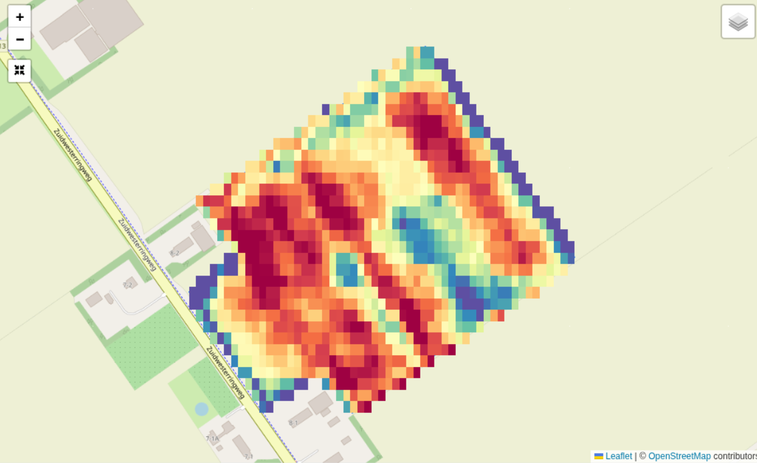
FarmDataViewer gives you a single place to manage all your field data. Whether you are mapping boundaries for the first time or importing existing data from RVO or other sources, everything comes together on an interactive map with satellite imagery.
- Interactive field mapping with satellite imagery
- Crop rotation tracking across multiple seasons
- Import from RVO (Gecombineerde Opgave) and other sources
- Public data layer overlays (WMS, WMTS, PMTiles)